
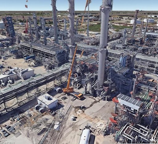
Subsurface Condition Assessment - Crane Placement
Lifting and/or hoisting is a hazardous work procedure that is typically performed in refineries, chemical plants or industrial facilities as a daily task. Heavy lifting is a complex and well-coordinated procedure that requires preliminary planning and engineering control. Part of the Job Safety Management process is to conduct a thorough job task related JSA and JHA prior to the field work. Based on that work procedure all possible known or unknown hazards must be assessed, eliminated and/or isolated from the work site before any work would start that could affect the success of the process. One of the important - if not the most important - aspect of the assessment is to conduct a subsurface study in and around the lifting zone.


It is always the best practice and highly recommended for Planners and Plant Engineers to start this process with a comprehensive Subsurface Condition Assessment or SCA. This is the most effective way to study the work site and essentially eliminate any subsurface hazards before the lifting in order to create and maintain safe work environment in the facility.
The Subsurface Condition Assessment is a complex ground investigation process that is generally carried out with joint Geophysical survey methods. Commonly used Geophysical instrument is the GPR also known as Ground Penetrating Radar that is capable to detect subsurface abnormalities (such as void, sinkhole, washouts) as well as buried pipes/utilities in the ground. If an underground void is unknown, that could pose a danger to the lifting process. The image below on the left is showing a typical GPR survey system that is used to produce 3D data of the scan area. The image next to it on the right is a basic principle of radar wave propagation in the ground.
The result of the SCA (Subsurface Condition Assessment) is an accurate void and utility map that will be used to find clear area for the crane setup or the outriggers (See image below). That information is also enclosed in a GIS (Geographic Information System) map or in a survey grade accurate drawing based on client’s request. Every piece of information is useful and subject to be posted in the report.
Image below is a sample image of a GPR 2D cross section that is indicating the result of analysis. Different types of anomalies are marked on the image.

GPR survey system that is used to produce 3D data of the scan area.

Basic principle of radar wave propagation in the ground.
Serious Incidents
Result of complacency could lead to near misses or serious incidents in the facilities. Caved in void(s) could cause cranes or above ground structures to collapse.

Collapse on job site.
It is important to be responsible about our workplace and crew members. Therefore due diligence is something that needs to be taken seriously.
The Values of a Subsurface Condition Assessment
One of the values of SCA is a pavement thickness map that provides valuable information about thickness variations within the lifting zone. Insufficient area with thin concrete pavement can be avoided by using this map.

The main value of the investigation is the void map that is generally overlayed on a base map that is typically a 2D/3D satelite image. Latitude, longitude coordinates with calculated depth information are also included in the GIS map.

In addition to the Geophysical NDE surveys, soil bearing capacity testing is also recommended for heavy crane placements. Ground stability needs to be tested to produce quantitative information about the soil conditions prior to beginning a project.